

 Image 1 of 5
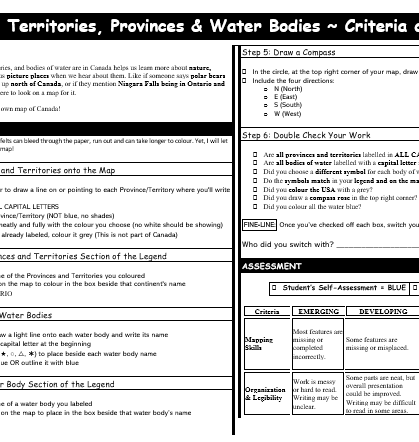 Image 2 of 5
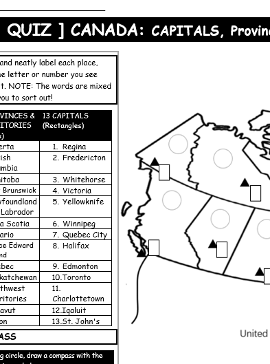 Image 3 of 5
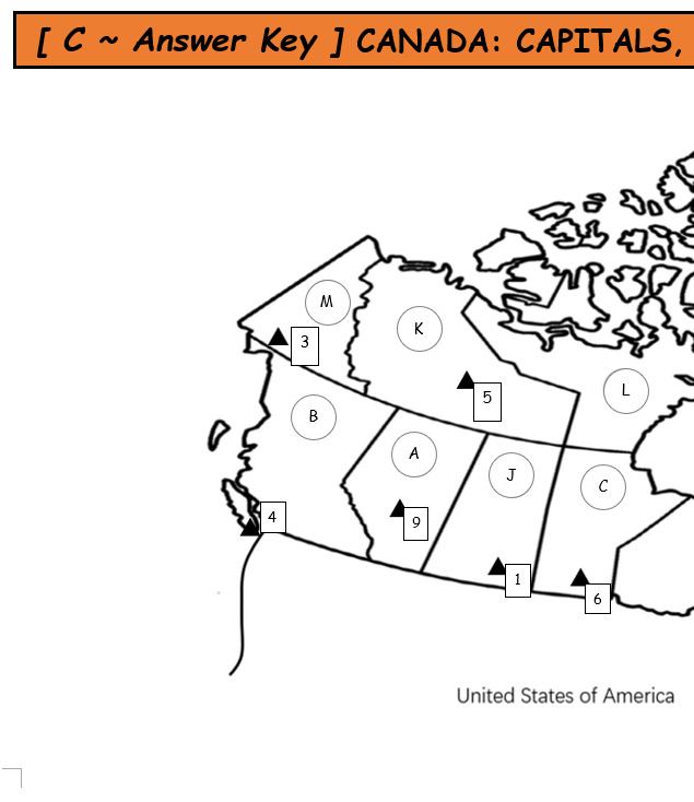 Image 4 of 5
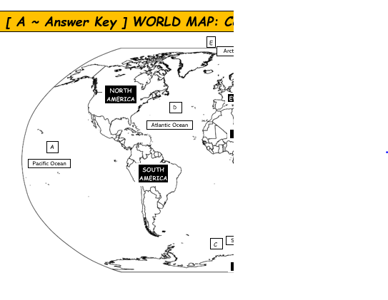 Image 5 of 5
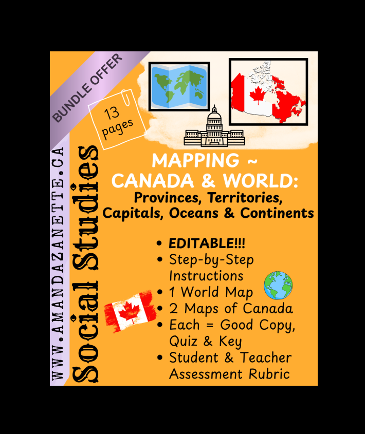
GRADE: 4-7 / TIME: About 1 Month (3 maps, 3 quizzes)
SS ~ MAPPING BUNDLE ~ WORLD + CANADA: Continents, Oceans, Provinces, Territories, Capitals (13 pages)
Take your students on a geography adventure with this comprehensive Mapping Bundle!
This hands-on, student-friendly resource includes three engaging map activities to help students explore the world and their own country:
[A] World Map: Learn the 7 continents and 5 oceans
[B] Canada Map #1: Identify provinces, territories, and major bodies of water
[C] Canada Map #2: Label provinces, territories, and their capital cities
Perfect for Grades 3–7, this resource helps students build essential map skills like reading a legend, using a compass rose, and following directions step by step.
Each Map Resource Includes:
Student-friendly step-by-step criteria sheet
Good copy map with legend
Quiz version of the map for review
Answer key map for reference
Student and teacher rubrics for easy assessment
Everything is print-and-go ready!
Great for:
Social Studies & Geography units
Independent work or good for early finishers
Homeschooling
Substitute plans
Differentiated learning and skill-building
TIPS: Print as 11 x 17 but you may want to shrink the quiz and answer key.
Younger Students: No need to print the full instructions ~ teach one step at a time on the board to reduce students being overwhelmed. Just start with the map! The quiz can also be used in pairs to encourage collaboration and reinforce learning.
Challenge Option: Remove names from the legend and have students research and label them independently. Encourage advanced learners to add mountain ranges, lakes, or additional geographic features for extra depth.