

 Image 1 of 5
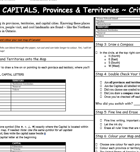 Image 2 of 5
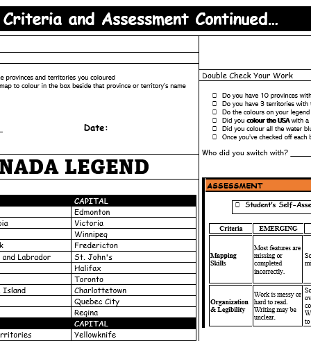 Image 3 of 5
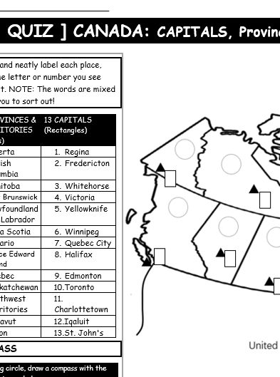 Image 4 of 5
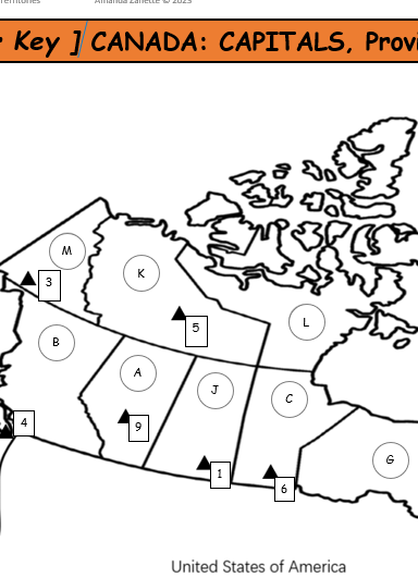 Image 5 of 5
GRADE: 4-7 / TIME: About 1 Week + Quiz
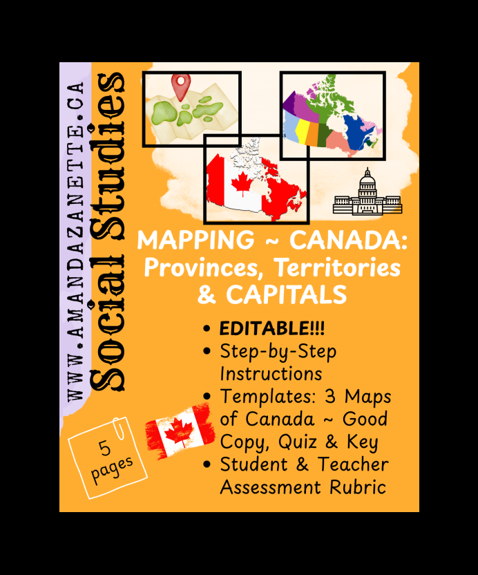
SS ~ MAPPING ~ CANADA: Capitals, Provinces, Territories (5 pages)
Explore Canada with this hands-on, student-friendly Map of Canada activity!
Perfect for Grades 3–7, this engaging lesson helps students learn the names and locations of Canada’s provinces, territories, and capitals, while also introducing key geography skills like using a map legend and drawing a compass rose.
Students will follow clear, step-by-step instructions to label, colour, and complete their own map of Canada, then reflect on their learning using a simple self-assessment.
This resource includes everything you need:
a thorough step by step guide for students to follow
a good copy map with legend
a quiz version for review
an answer key map
student and teacher rubrics for easy assessment
All materials are print-and-go ready!
Great for Social Studies, Geography units, early finishers, homeschool, or as a substitute-friendly activity!
TIPS: Print as 11 x 17 but you may want to shrink the quiz and answer key.
Younger Students: No need to print the full instructions ~ teach one step at a time on the board to reduce students being overwhelmed. Just start with the map! The quiz can also be used in pairs to encourage collaboration and reinforce learning.
Challenge Option:For students who need an extra challenge, cover the names of provinces, territories, and/or capitals in the legend using white-out or paper strips. Have students research and label them independently. You can also invite them to add mountain ranges, seas, or other key geographic features to their map.
GRADE: 4-7 / TIME: About 1 Week + Quiz
SS ~ MAPPING ~ CANADA: Capitals, Provinces, Territories (5 pages)
Explore Canada with this hands-on, student-friendly Map of Canada activity!
Perfect for Grades 3–7, this engaging lesson helps students learn the names and locations of Canada’s provinces, territories, and capitals, while also introducing key geography skills like using a map legend and drawing a compass rose.
Students will follow clear, step-by-step instructions to label, colour, and complete their own map of Canada, then reflect on their learning using a simple self-assessment.
This resource includes everything you need:
a thorough step by step guide for students to follow
a good copy map with legend
a quiz version for review
an answer key map
student and teacher rubrics for easy assessment
All materials are print-and-go ready!
Great for Social Studies, Geography units, early finishers, homeschool, or as a substitute-friendly activity!
TIPS: Print as 11 x 17 but you may want to shrink the quiz and answer key.
Younger Students: No need to print the full instructions ~ teach one step at a time on the board to reduce students being overwhelmed. Just start with the map! The quiz can also be used in pairs to encourage collaboration and reinforce learning.
Challenge Option:For students who need an extra challenge, cover the names of provinces, territories, and/or capitals in the legend using white-out or paper strips. Have students research and label them independently. You can also invite them to add mountain ranges, seas, or other key geographic features to their map.